Digital Literacy & Online Safety
Real-World Use Case 2: Preserving Cultural Heritage
Digital Preservation & Virtual Tours
Cultural heritage NGOs face a constant race against time. Let's explore how web technologies and panorama imaging are being used to protect history and boost local awareness.
Tap an image below to reveal how the technology works step-by-step!
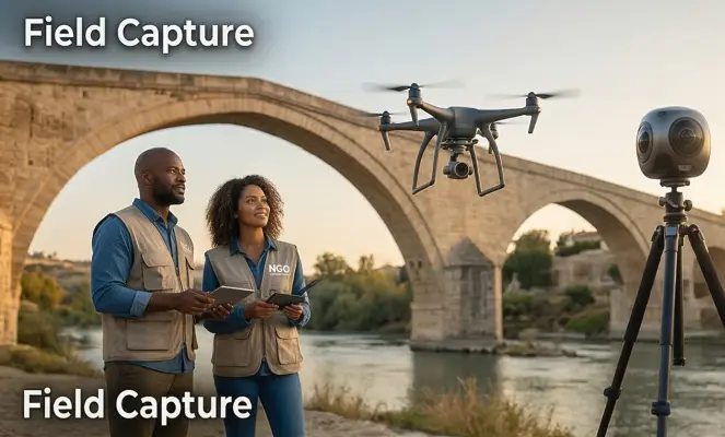
Step 1: Field Capture
The NGO sends a small team equipped with consumer-grade 360° cameras and a standard drone to a historic site. They capture high-resolution, equirectangular panoramic images from multiple viewpoints around and above the structure.
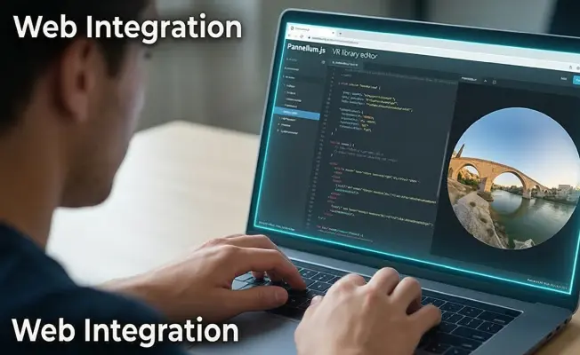
Step 2: Web Integration
Using simple HTML and an open-source JavaScript library like Pannellum, a web developer links the 360° images together. They add interactive "hotspots" to the code, allowing users to click and "walk" from one viewpoint to the next.
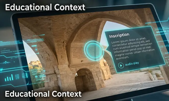
Step 3: Educational Context
Information points are overlaid onto the virtual tour. When a user hovers over a specific archway or inscription on the digital bridge, a text box or audio clip pops up explaining its architectural and historical significance.

Step 4: Global Access & Grants
The completed virtual tour is embedded on the NGO's website. Schools can use it for remote field trips, and the NGO can present this interactive digital proof to international heritage foundations to secure funding for physical restorations.
The following link presents the "SHARED HORIZONS" project as a real-life example of this approach. Six bridges from the Western Balkans have been selected for which young people have written stories, of which 3 have been selected for each bridge and for which virtual tours have been created.
Each bridge will have a QR code with access to the stories about it, and the next step could be a mixed reality application where the real footage on site will be intertwined with the virtually created story.
Shape the Future.
Mint the Change.